blah blah blah
Hyland Hill
Length: 2.6 miles out-and-backDifficulty (click for info): Beginner
Elevation Gain: 550 feet (+40 feet on return)
Rating (click for info): 4/10
Elevation: 1509'
Prominence: 653'
Driving Directions:
Trailhead is on Hurricane Road in Keene, NH (summit is in Westmoreland). To get there, turn south onto South Village Road off Rt. 12, 3.6 miles east of Rt. 63 and 4.6 miles west of Rt. 12A. Drive 0.6 miles, then take a left onto Hurricane Road and travel 1.6 miles. At a left bend, look for a gated road descending at a sharp angle on the right, and park on the roadside. Click here for a Google map.
About the Hike:
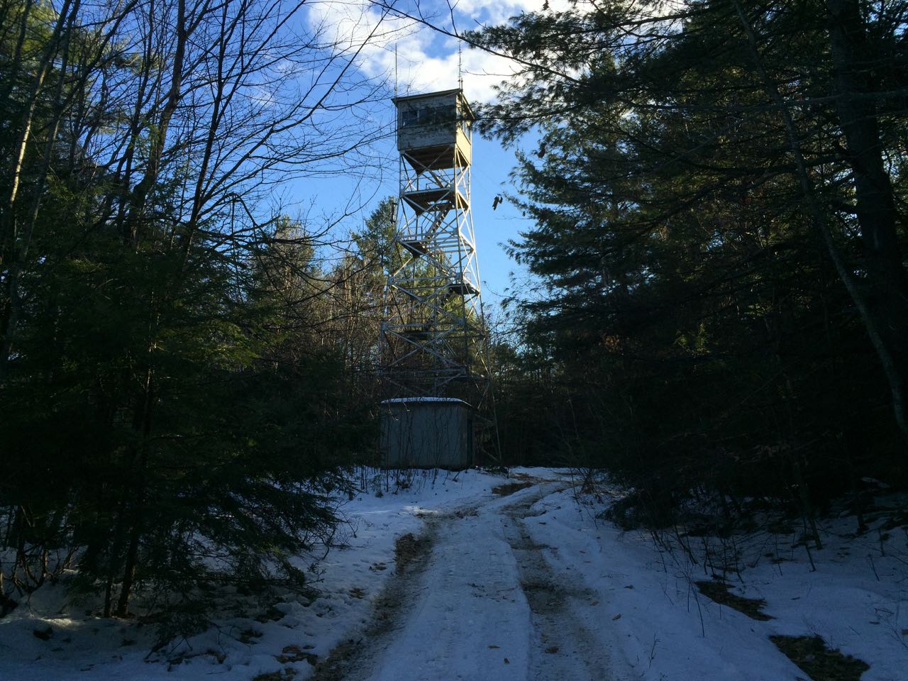
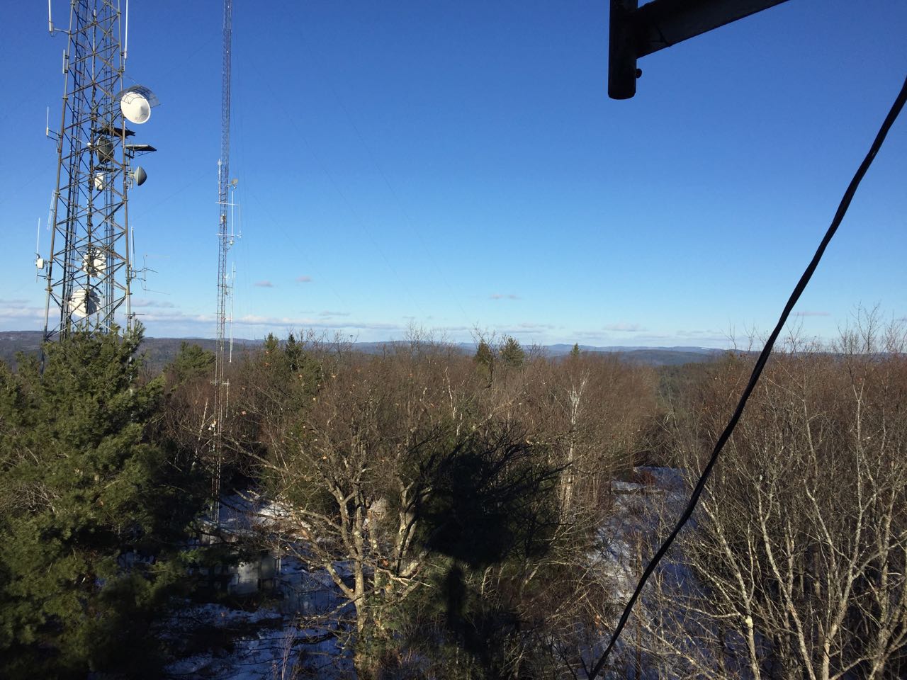
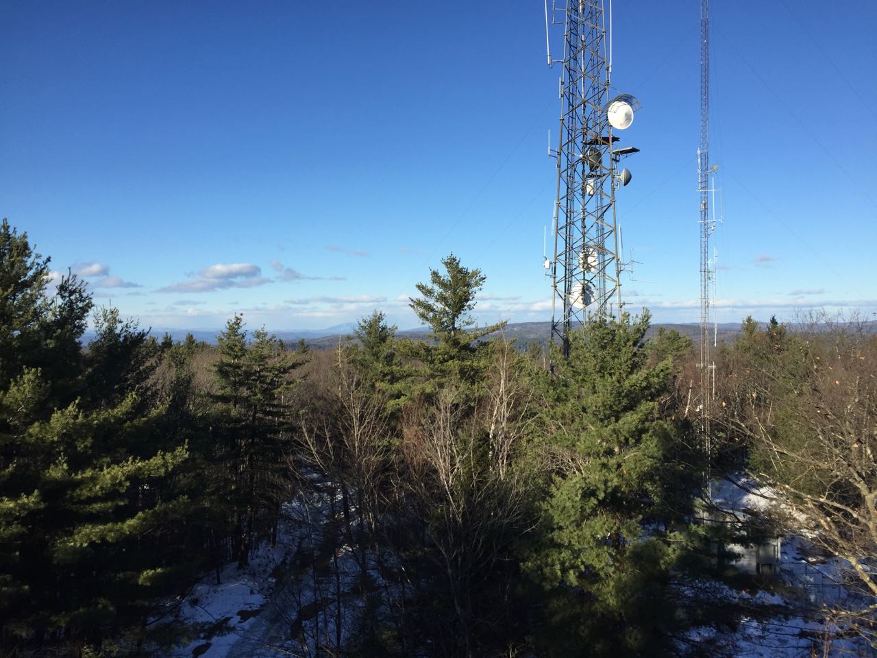
Hyland Hill is a long ridge lying just outside the western boundary of the city of Keene. An inactive fire tower stands on the highest point, along with some communications towers. Built in 1930, the Hyland Hill Tower was one of the more recently operating towers, going out of service in 2005. Today, the tower is no longer kept up, and tree growth has obstructed a lot of the view. It is still in good shape, however, and it is a nice place to visit if you are nearby. It is best to climb the hill when the leaves are off the trees so that more of the diminished view can be seen.
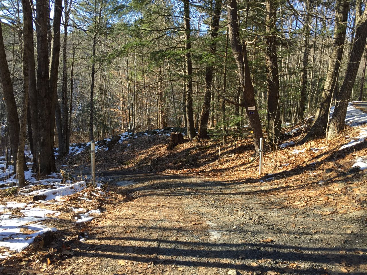
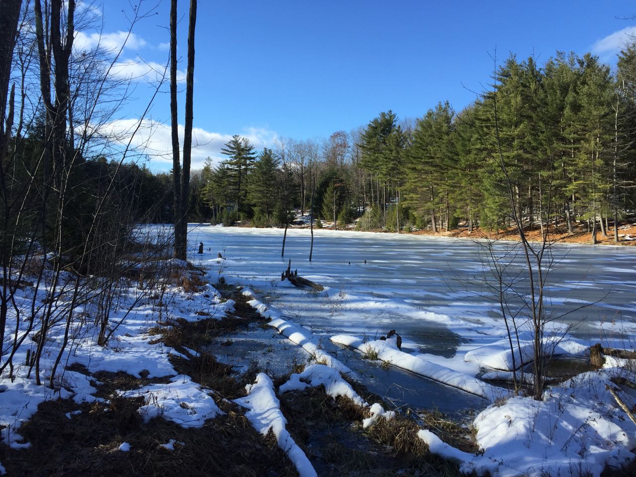
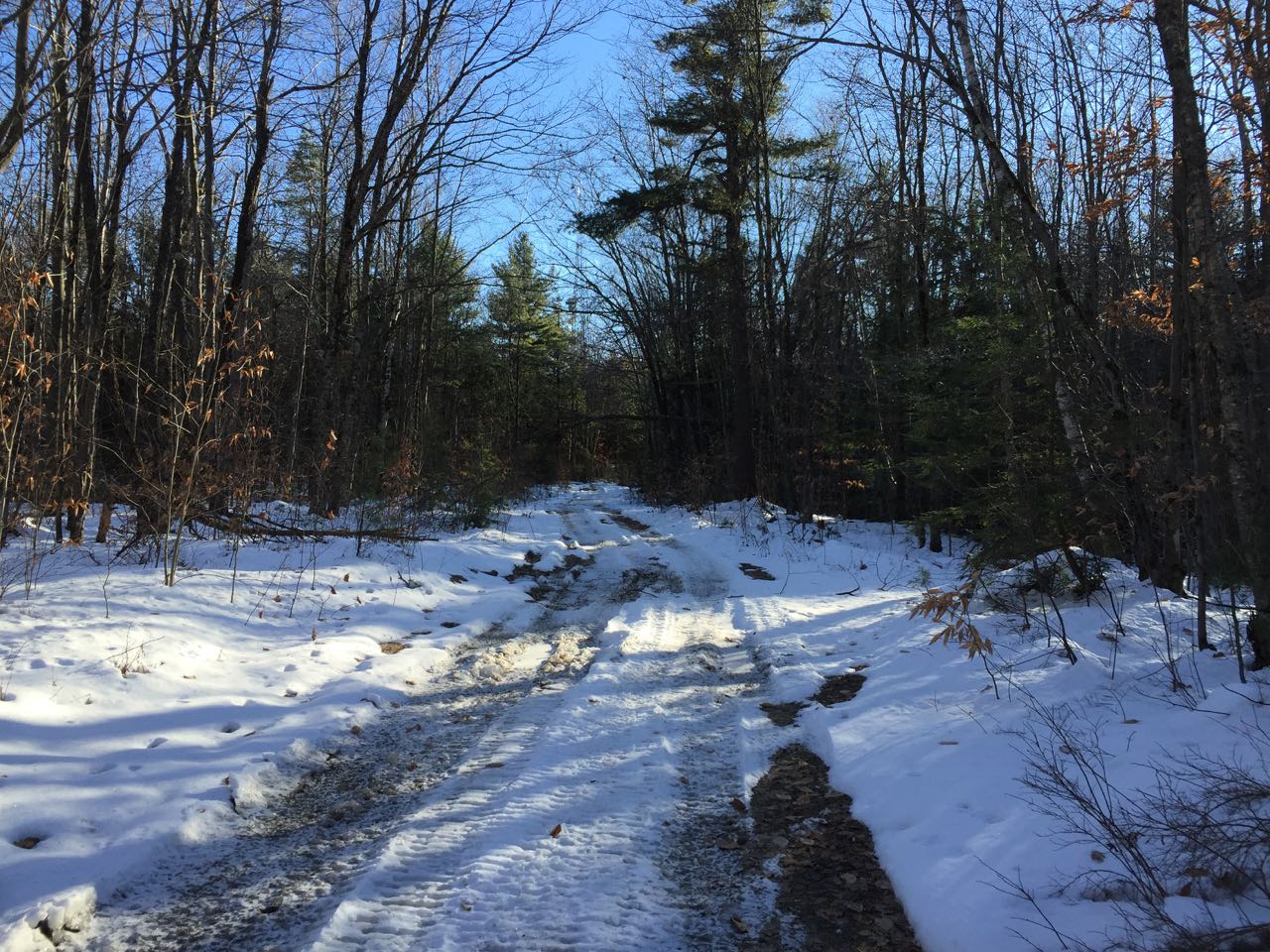
From the unmarked trailhead, head down the dirt access road, which drops to cross a wetland area, then begins climbing easily. The road approaches a brook on the left in 0.15 miles and follows it uphill. Several signs posted on trees note that the area is monitored by video cameras. You will follow the brook for 0.3 miles before the road crosses over it and arrives at a T-junction. Turn left, take a few steps further up the road, and look for a path on your right that leads out to the shore of a small, marshy pond. After viewing the pond, continue on the main road as it ascends moderately through recently logged areas. In another 0.3 miles, turn left onto another unmarked road which runs flat across the hillside as the main road continues uphill ahead. It gains no elevation for 0.1 miles, then swings slightly uphill and climbs another 0.1 to a rather flat area near the top of the hill. Pass through a gate and reach the summit towers in 0.2 miles. Find the fire tower just beyond the cell towers. If there are no leaves on the trees, you will have a decent view into the distance over the treetops upon climbing the tower. Mt. Monadnock can be seen through the branches over to the east, while Mt. Ascutney is a prominent feature in the distance over the road.
Printable directions page